Technology
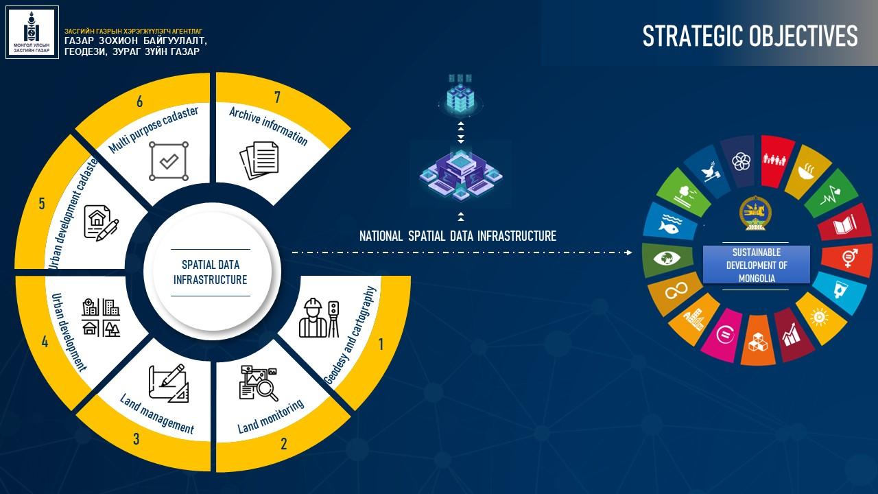
In Mongolia, an action plan for the establishment of a national spatial data infrastructure has been developed, and the matter of infrastructure establishment consists of 3 parts. However, these 3 parts are interrelated.
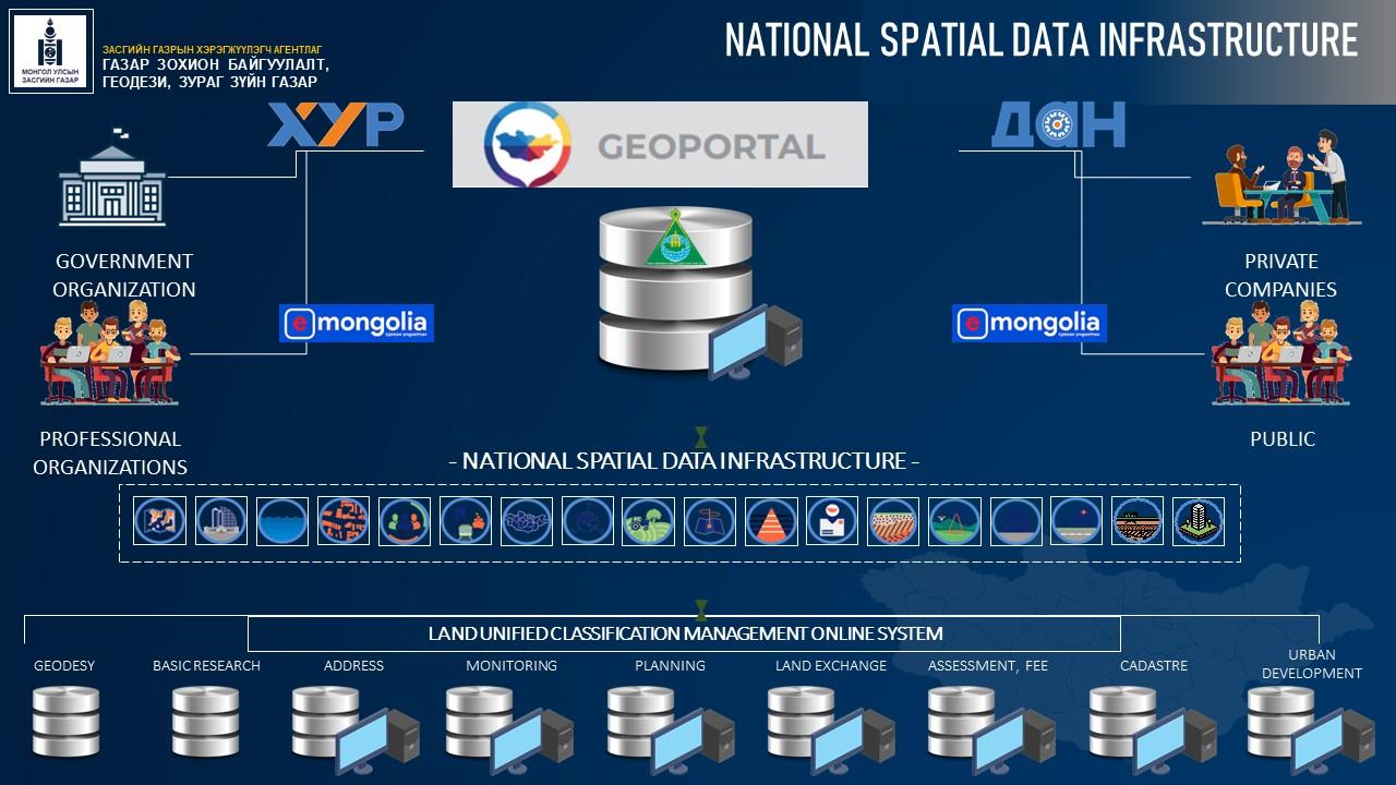
In Mongolia, there are many governmental and non-governmental organizations that create and use spatial databases, and they have completed coordination of standards and documents related to the coordination of these databases, the creation of a integrated system of spatial data and information, and the integration of spatial data.

Part of the action plan for the establishment of the National Spatial Data Infrastructure is the establishment of the National GEOPORTAL online system.
The national GEOPORTAL online system ensures inter-organizational coordination, creates and uses spatial data in accordance with unified standards, and ensures budget overlap, innovation and reliability of information.


