Geodesy and topographic map database
The State Geodesy and Cartography Agency was established by Resolution No. 232 of the Council of Ministers of the People's Republic of Mongolia in 1970 in order to centralize the geodetic and cartographic work carried out in the territory of Mongolia with a unified plan and strengthen its material base.
At that time, the Ministry of Defense, the Ministry of Fuel and Energy, the Ministry of Geology, and the Ministry of Agriculture funded 6 types of topographic maps, photo plans, photo schemes, aerial photography negatives, reproductions, and montages. The first fund was established under the name of “Geocard” fund and developed in line with the level of defense and socio-economic development of Mongolia.
In 1971, for the first time in the country, topographic maps with scales of 1: 1 000 000, 1: 500 000, 1: 200 000, 1: 100 000 were counted and registered in the unified registry, and temporary instructions for the use of maps were developed and approved by the Ministry of Construction and Building Materials and the Ministry of Social Security.
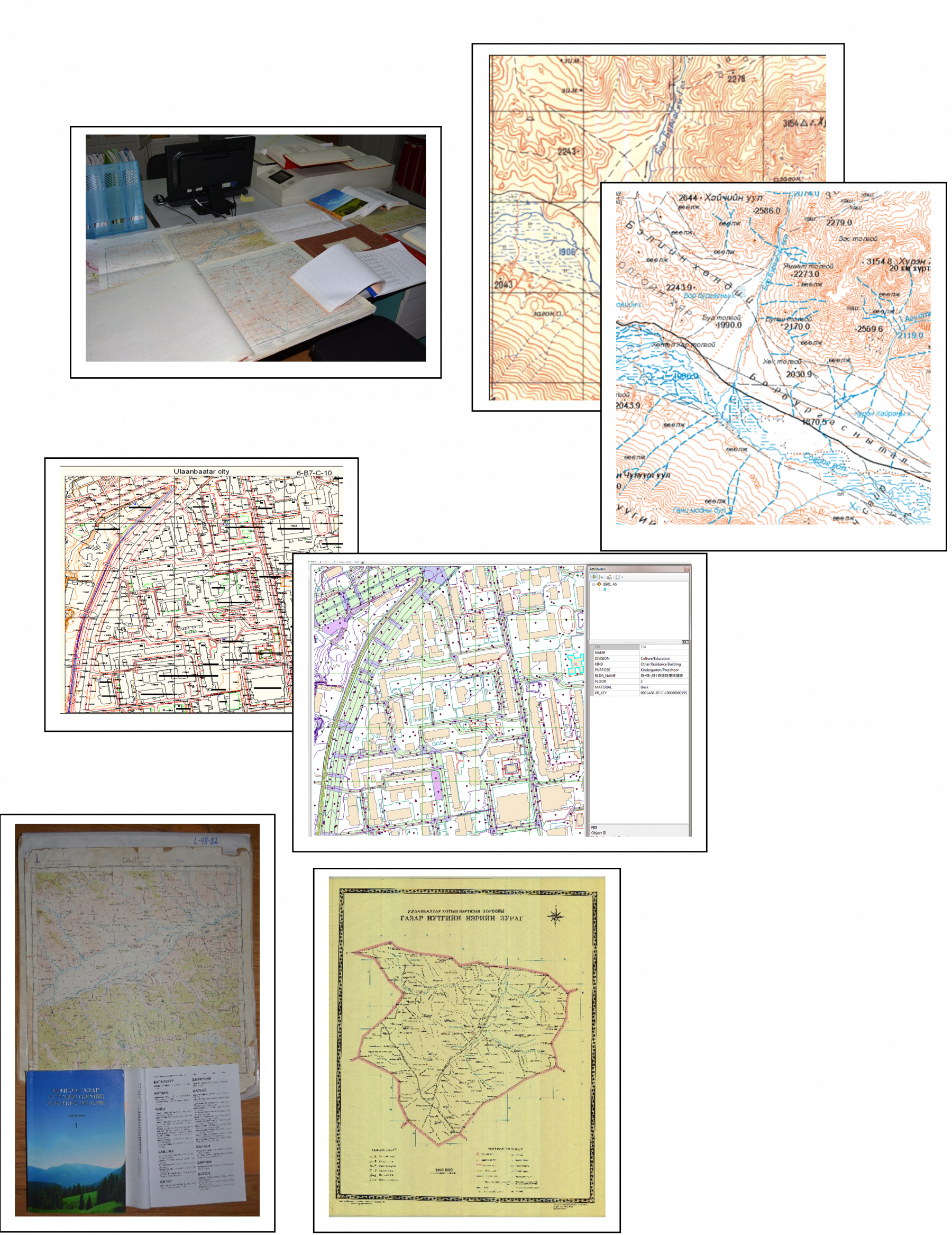
Geodetic and cartographic information has been used since 1932 to store, protect, enrich, and create and disseminate information. The archive has stored a total 16,389 units of which are 377,424 paper based and more than 1,000 electronic media. These include:
· Catalog, report, coordinates, and other relevant documents of triangulation, gravimetry, level network point and symbol completed between 1963-2016 covering the whole territory of Mongolia,
· 1:10000, 1:25000, 1:50000, 1:100000, 1:200000, 1:500000, 1:1000000 scaled topographic paper and digital images,
· Mapping documents along the Mongolian border,
· Geographical names of Mongolia,
· Urban cadastral map,
· Training maps and atlases.